 Thông cáo báo chí
Enhancing capacities to use localized climate and disaster risk information to help communities plan for a safer future
Viet Nam is among the countries considered to be most at risk from climate change and disasters globally, and in recent years has been experiencing their impacts with increasing frequency and intensity. In 2020 alone, disasters such as floods, storms, and droughts caused hundreds of deaths, severe property loss, and high economic costs.
Addressing these compounding challenges effectively demands that decision-makers take climate and disaster risks into serious consideration when planning for the future. While collecting, analyzing, and integrating risk data into socio-economic development plans is increasingly critical to building sustainability and resilience, however, the concept of ‘risk-informed development’ is still relatively new in Viet Nam.
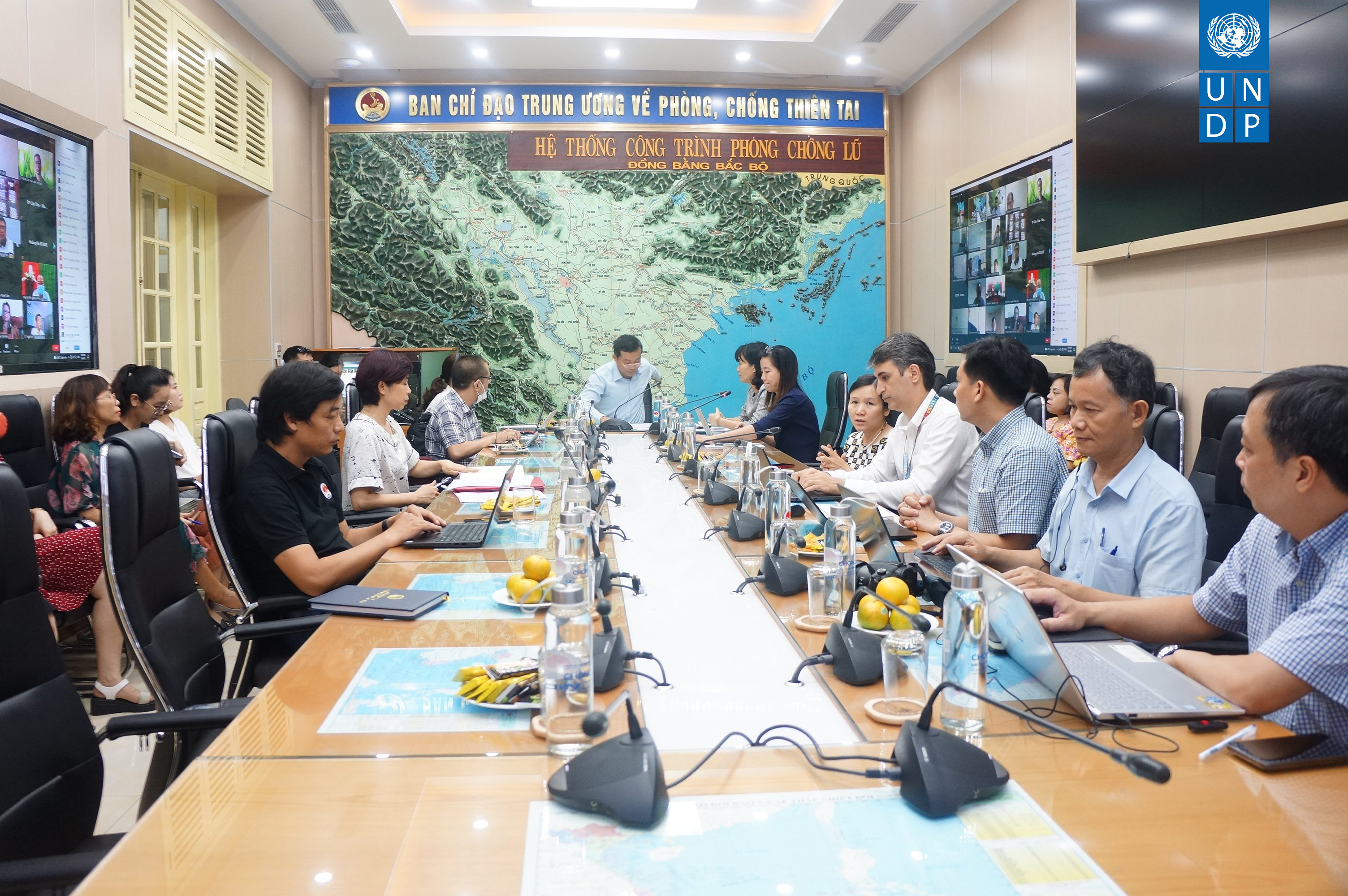
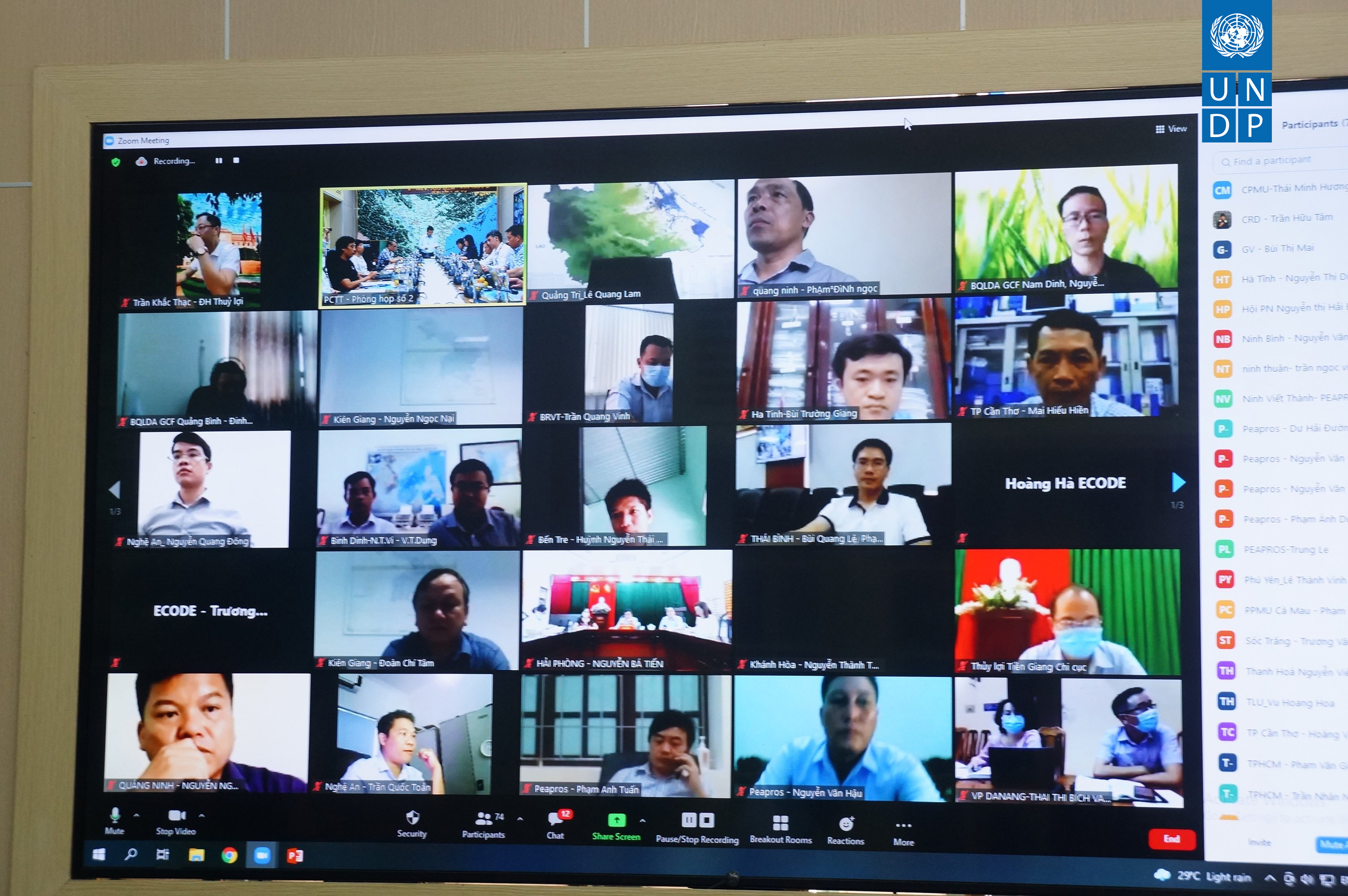
To raise public awareness of climate and disaster risk and contribute to the integration of risk information into socio-economic development planning, the United Nations Development Programme (UNDP) hosted an online training workshop on community-based disaster risk management (CBDRM) in Viet Nam on 06-07 July 2021.


Representatives from the Viet Nam Disaster Management Authority (VNDMA), UNDP, and the project’s seven provincial project management boards were in attendance, as well as officials from the Women’s Union and 82 delegates from the Commanding Committees on Natural Disaster Prevention and Control and Search and Rescue from 21 coastal provinces.
The “Risk Packages”
For the past two years, UNDP has been working with VNDMA, the Center for Eco-Community Development (ECODE) and the seven coastal provinces collecting and analyzing risk information, which was then turned into so-called “Risk Packages,” also referred to as “RiskPacks.”
As a part of the training course, Mrs. Hoang Thi Ngoc Ha, Director of ECODE, introduced methods for collecting and analyzing risk information and taught attendees how to apply them in CBDRM training courses in coastal provinces using the “RiskPacks.”
The “RiskPacks” are one of the products developed under the third component of the GCF coastal resilience project, which focuses on promoting greater integration of climate and disaster risk information into local planning processes in seven coastal provinces (Nam Dinh, Thanh Hoa, Quang Binh, Thua Thien Hue, Quang Nam, Quang Ngai, and Ca Mau).
Each “RiskPack” includes a system of disaster and climate risk maps developed for one of the seven provinces, including digitized commune hazard maps, and a lecture system to be used in training activities on disaster risk management, adaptation to climate change, and community-based disaster risk assessment.
Integrating climate and disaster data is key to risk-informed planning
During the workshop, the methodology on integrating climate and disaster risk information into local socio-economic development planning was shared with participants. A number of criteria for integration were also clarified, including relevance, sustainability and feasibility.
Authorities, local people, and experts can use the “RiskPacks” to assess the scale and scope of disaster risks in their communities, helping ensure that socio-economic development plans:
• Consider the increase of frequency and intensity of future hazards due to climate change
• Prevent the creation of new risk
• Support disaster risk reduction and build resilience against climate change impacts
Expressing his appreciation for the key role the “RiskPacks” have played in local planning, Mr. Dang Van Viet Phuong, coordinator of the GCF Project Management Unit for Thua Thien Hue Province, stated that “the Provincial Project Management Unit agrees with the trainers, and is implementing the Risk Pack report’s proposed disaster prevention solutions into the corresponding section of socio-economic development plans being developed in the province. Currently, the GCF project aims to expand the toolkit to 21 more provinces. I propose that the project continue to support provinces in developing disaster risk reduction plans for 2021-2025 with the participation of the community, and expand the model of integrating disaster and climate risk information into socio-economic development plans.”
Currently, 313 communes and 40 districts, cities, and towns of the seven coastal provinces have access to risk-related information provided by the “RiskPacks.” Thanks to this training workshop, this important work is beginning to reach decision-makers in all of the remaining 21 coastal provinces that have not yet been able to benefit from the “RiskPacks,” helping to raise public awareness and build community resilience.
The training workshop was organized under the framework of the project “Improving the resilience of vulnerable coastal communities to climate change related impacts in Viet Nam,” which is financed by the Green Climate Fund (GCF) and implemented in collaboration with the Government of Viet Nam.
 Tin mới
- Lồng ghép nội dung Phòng, chống thiên tai vào quy hoạch, kế hoạch phát triển ngành, kinh tế - xã hội tại địa phương (07/04/2022)
- Thúc đẩy mạng lưới doanh nghiệp tiên phong và chủ động trong phòng chống thiên tai, ứng phó biến đổi khí hậu và dịch bệnh (15/10/2021)
- Lễ phát động cuộc thi “Tìm kiếm sáng tạo truyền thông về giảm thiểu tác động của thiên tai và biến đổi khí hậu” (12/10/2021)